

-
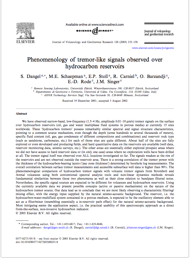
- Scientific Article, Dangel et al, 2002
-
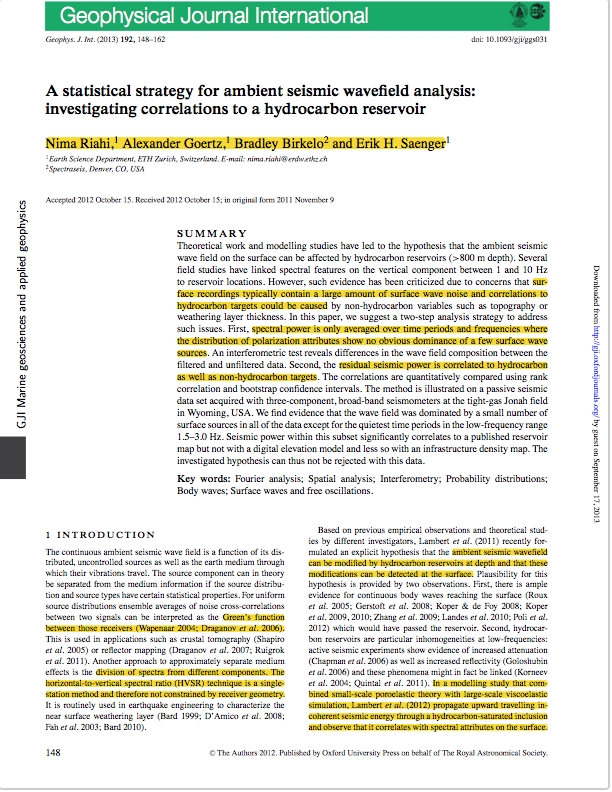
- Scientific Article, Riahi et al, 2011
-
- Remote Sensing results
-
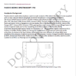
- Passive Seismic Spectroscopy report
-
- TAC Presentation to MME, 2019
-
- Integration Report, 2019
-
- Passive Seismic Spectroscopy paper
-

- Data Integration
-

- Regional Study
-
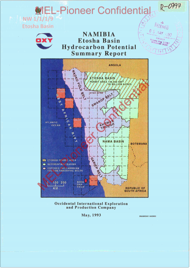
- Etosha Basin Namibia, Hydrocarbon Potential
-
- Cooperation Presentation

-
- Technical Presentation
-

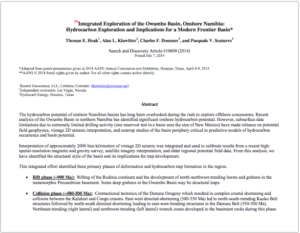
- Scientific Article, Hoak et al, 2014
-
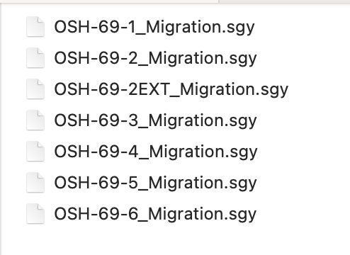
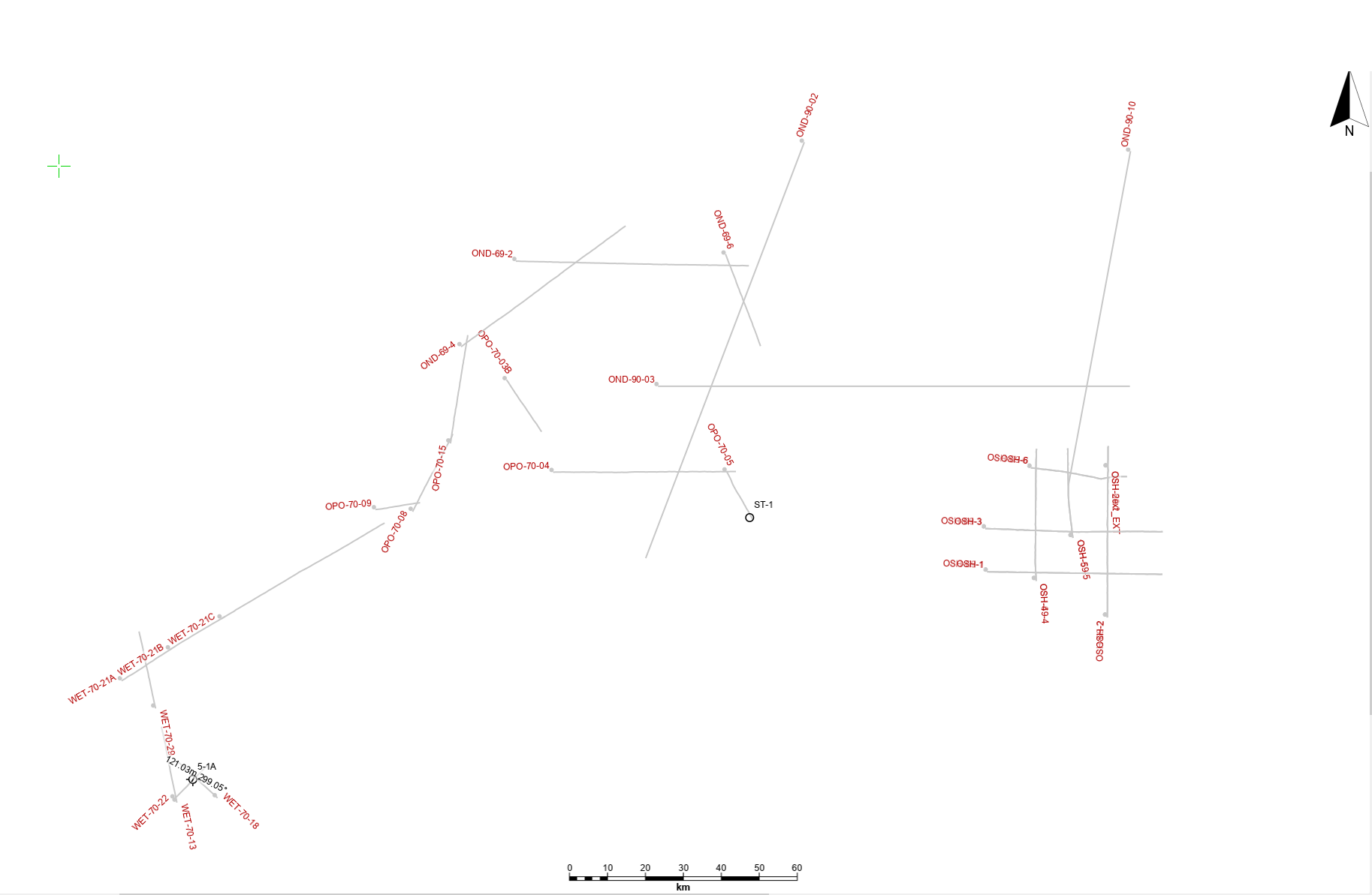
- 2D Seismic OSH-69-SEGY
-
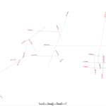
- 2D-seismic-lines-owambo-basin
-
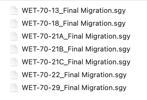
- wet-70-segy-seismic-lines
-
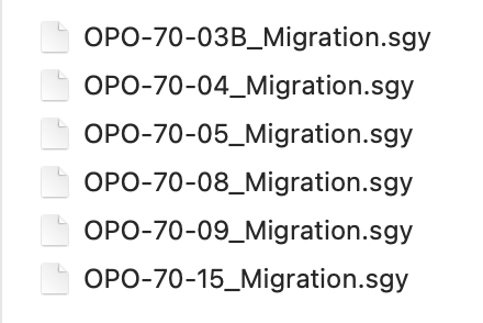
- opo-70-segy-seismic-lines
-

- ond-90-segy-seismic-lines
-
- ond-69-segy-seismic-lines
-
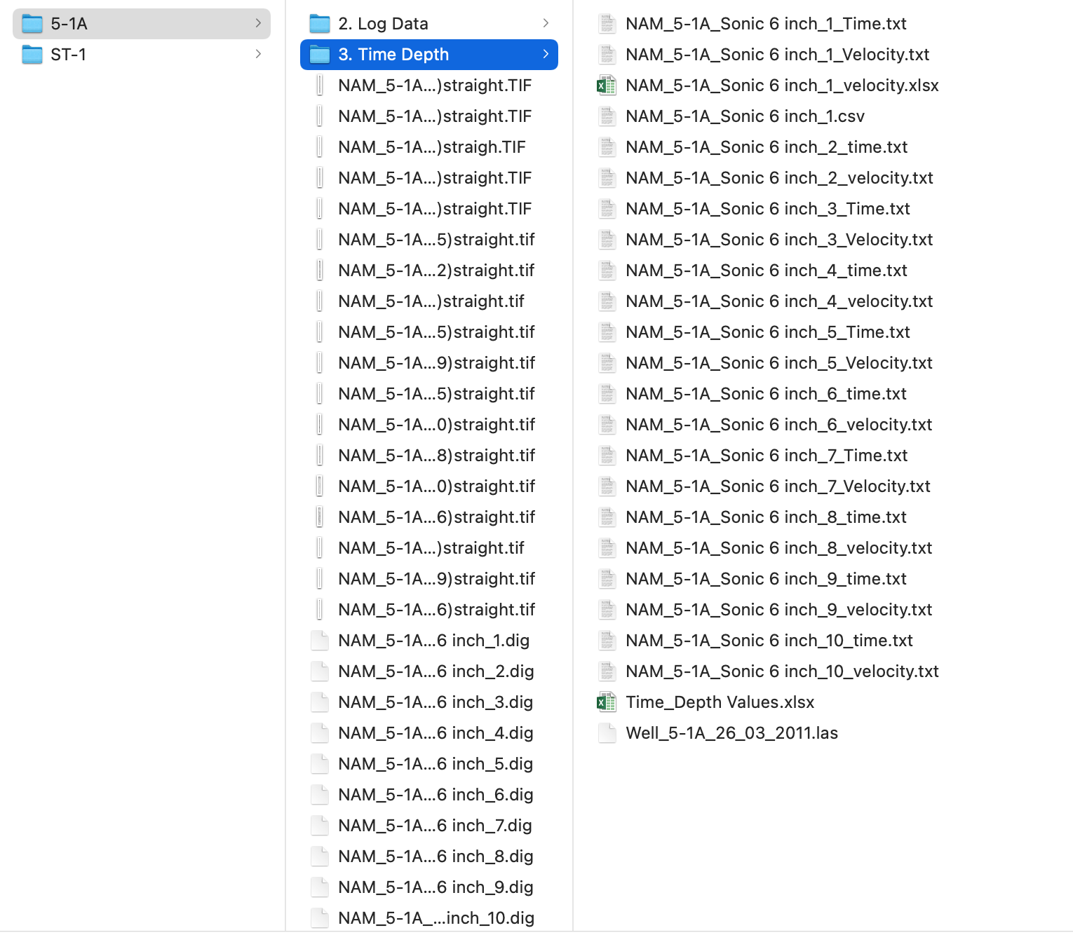
- Etosha-5-1a-well-logs
-
- Etosha-5-1a-well-logs
-
- Etosha-5-1a-well-logs
-

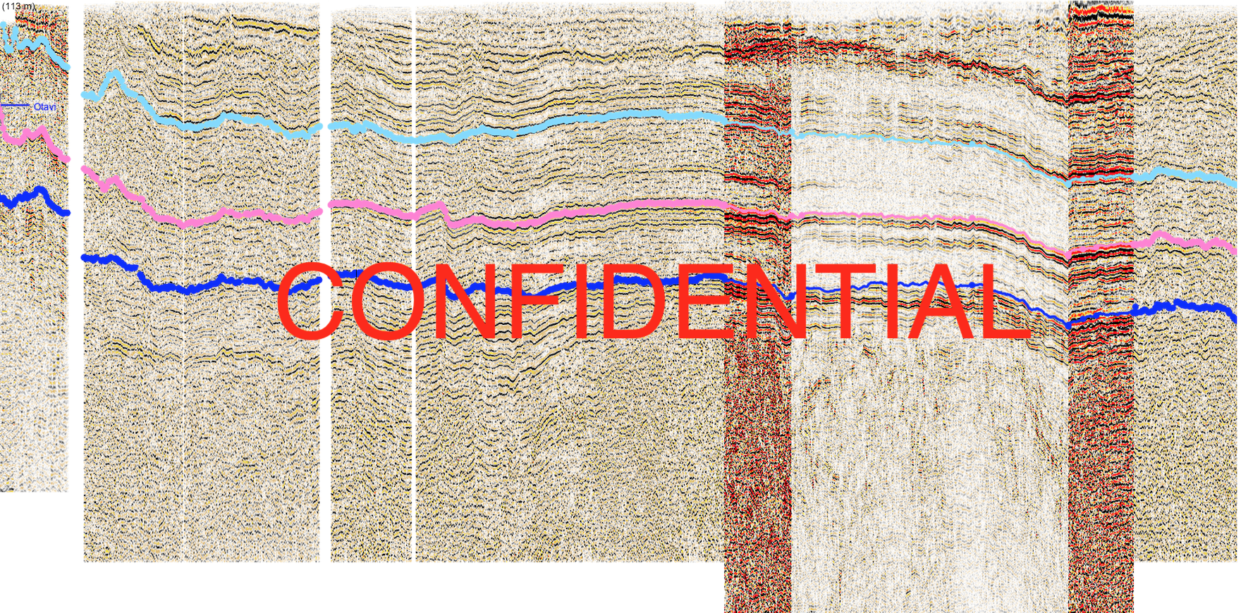
- 2D seismic-wells-AOI-tie-PEL93-1817-1717
-
- Environmental Impact Assessment for 2D seismic, 2022

-
- Environmental Management Programme for 2D seismic, 2022
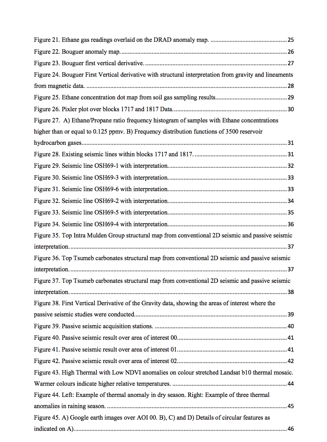
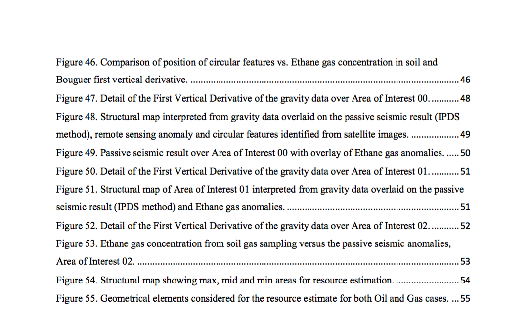
Integration Report and Hydrocarbon Prospectivity of PEL 93, BLOCKS 1717 & 1817, Owambo Basin, Namibia
Prepared by: PIONEER OIL AND GAS CONSULTING
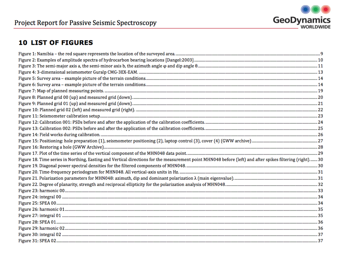
Passive Seismic Spectroscopy Study
Prepared by: Geodynamics WorldWide, Italy
Date: March 2019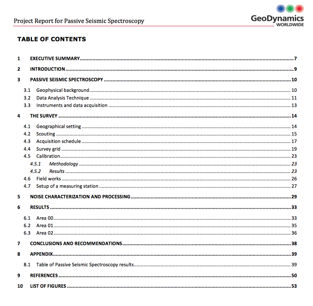
Remote Sensing Hydrocarbon Study
Prepared by: Airbus Defence
Date: September 2018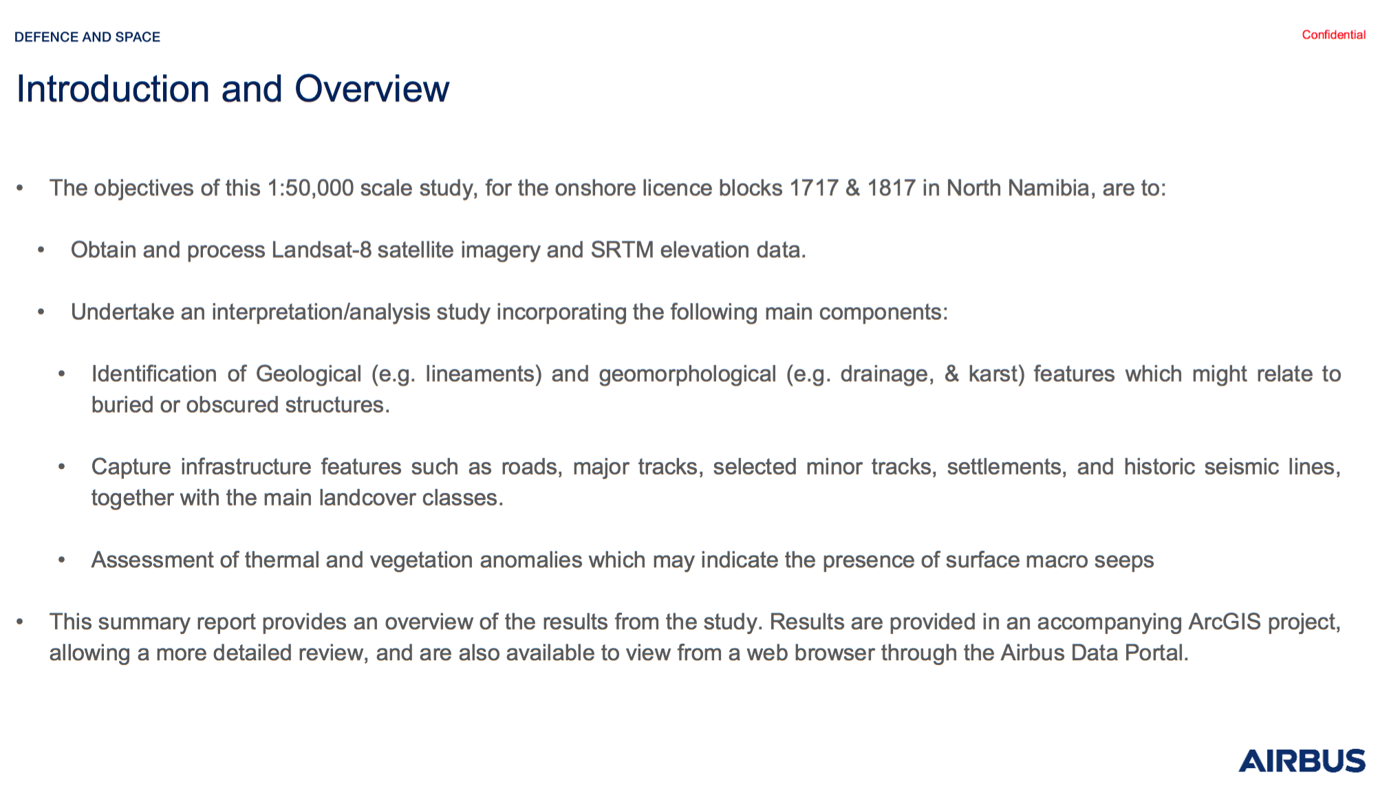
MEL OB – 203 km of 2D seismic lines – Vibroseis – year 2024
MEL-OB-24-01.sgy
MEL-OB-24-02.sgy
MEL-OB-24-03.sgy
MEL-OB-24-04.sgy
MEL-OB-24-06.sgy
MEL-OB-24-07.sgy
MEL-OB-24-09.sgy
MEL OB – 60 km of 2D seismic lines – AWD – year 2023
MEL-OB-23.03.sgy
MEL-OB-23-10.sgy
OSH 69 – 220 km of 2D seismic line

 021
021


Geochemical Soil Gas Survey
2013
SurfaceGeochemicalTechniques
SurveyObjectives
SurveySummary
Original Survey Design
FieldTraining
UltimateSurveyCoverage
SurveyResults
Analogs
Conclusions And Future Plans
CurrentActivity
SummaryofPhase1WorkToDate
2014ProposedWorkProgram
Acquisition of Magnetic and Radiometric Grids: used into the geophysical interpretation – coverage 18,500 km2
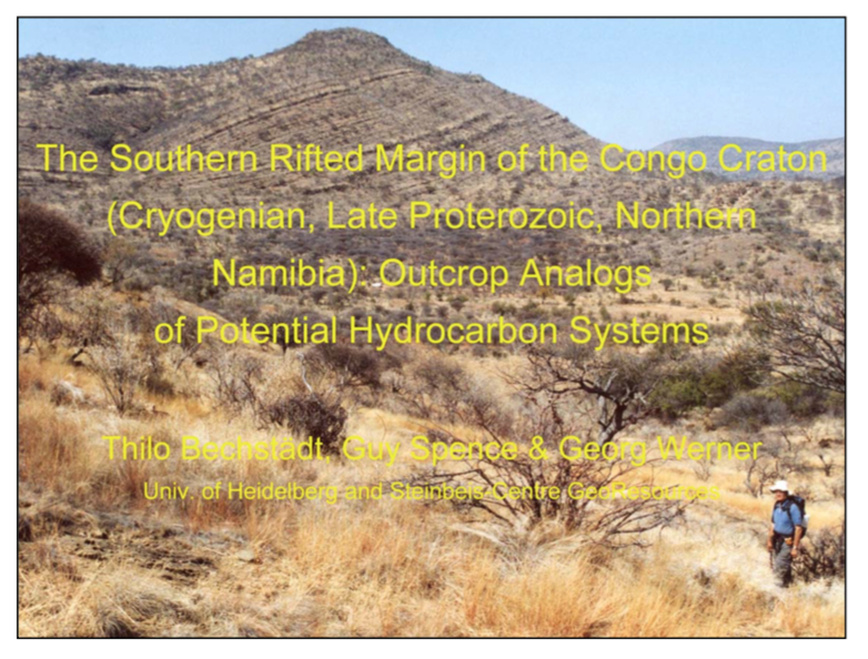
The Southern Rifted Margin of the Congo Craton (Cryogenian, Late Proterozoic, Nothern Namibia): Outcrop Analogs of Potential Hydrocarbon Systems
Report of 29 pages
Etosha Basin Hydrocarbon Potential Summary Report
Date: May 1993


NAMA BASIN EXPLORATION OPPORTUNITIES BLOCKS 2416A AND 2417
Prepared by: PIONEER OIL AND GAS CONSULTING
Date: October 2019
“…In general, both areas represent an eye-catching hydrocarbon exploration scenario due to their favorable geological setting with high likelihood to contain active petroleum systems. Figure 2 shows the depth to basement map for the basin; note that the depocenters (blue colors) are within and the proximity of the blocks, which reduces the risk of migration and charge of hydrocarbons in the traps. Tectonics could have played an important role in the process as deep seated faults (black dashed lines in Figure 2) associated to Namaqua fold belt could represent feasible migration pathways for migration of hydrocarbons…”