


-
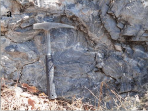
- Fractured carbinates
-

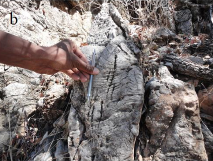
- Apparent stromatolite
-
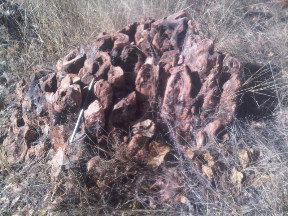
- Stromatolites of the Huttenberg Formation
In February Monitor commenced an airborne high-resolution gravity, magnetic and radiometric survey over PEL 93 in the Owambo basin to further derisk the upcoming selection of drilling locations in H2-2026.
ECC extension was granted to run 6,000 km of airborne gravity survey planned for Q1-2026. OCM and TAC meetings were held, Monitor is on track with its technical and financial commitments and local content engagement; the 2026 Work Program & Budget was approved by MIME.
Monitor conducted an extensive local community campaign in the Owambo Basin area to inform landowners and regional authorities about the upcoming airborne gravity/aeromagnetic/radiometry survey. The outreach ensured that all stakeholders were aware of any potential external implications, with clear assurances that the survey poses no danger or harm to people, livestock, or property. Acquisition of the airborne survey is deferred to January 2026 due to Contractor delays.
Monitor is granted a one-year extension to the current licence period, now extended until Oct 2026, allowing time to plan and carry out an airborne high-resolution gravity, magnetic, and radiometric survey covering 6,000 line-km, scheduled for Q3 2025. TAC approved PEL 93 Work Program & Budget through to 31 Dec 2025, supporting Monitor’s planned exploration activities.
.
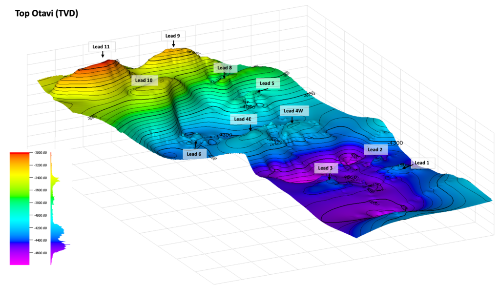
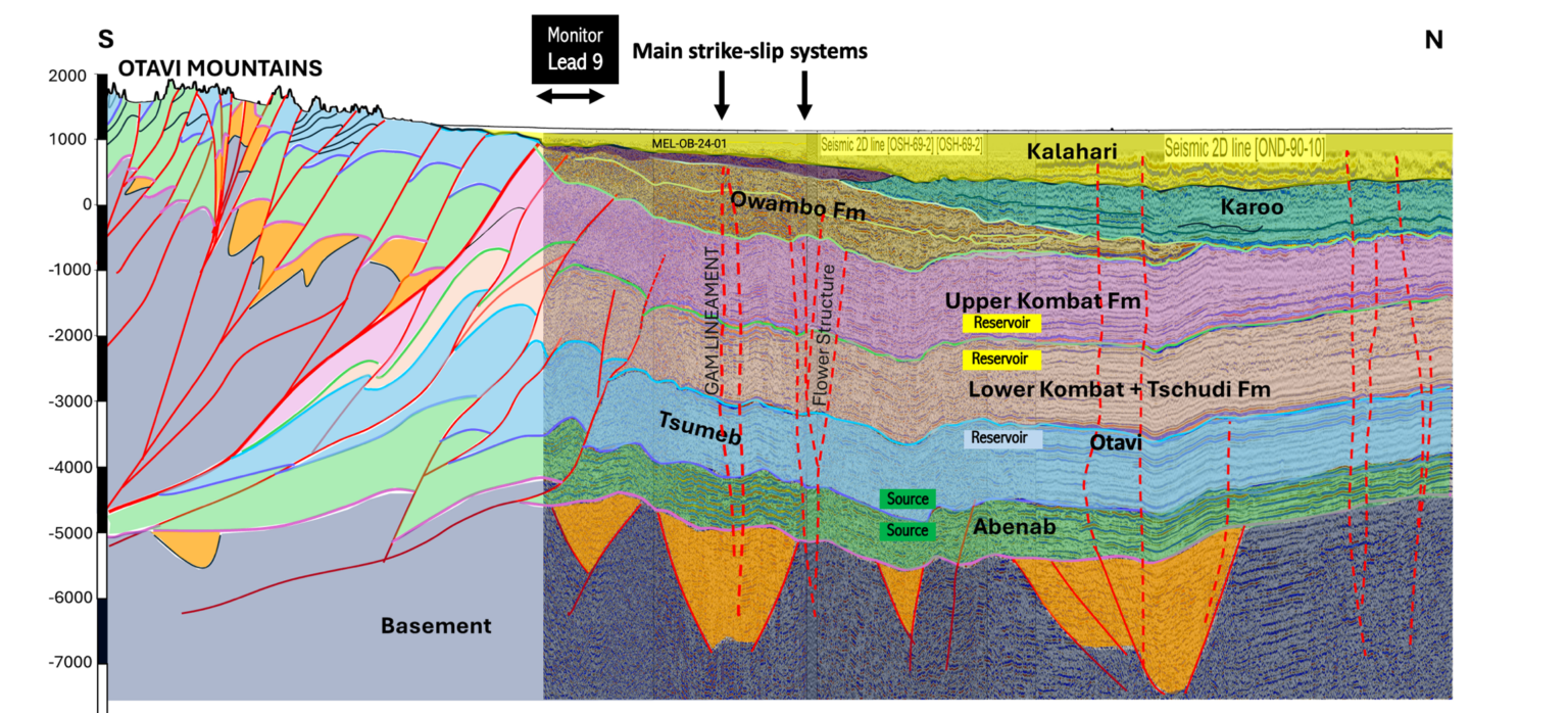
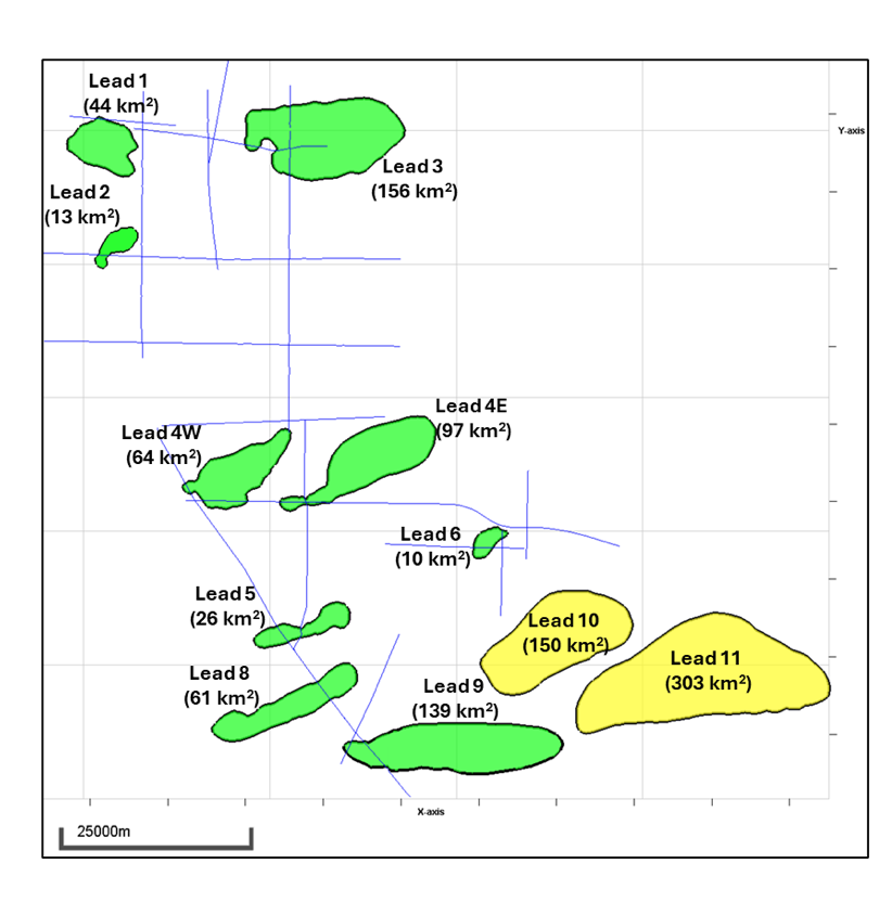
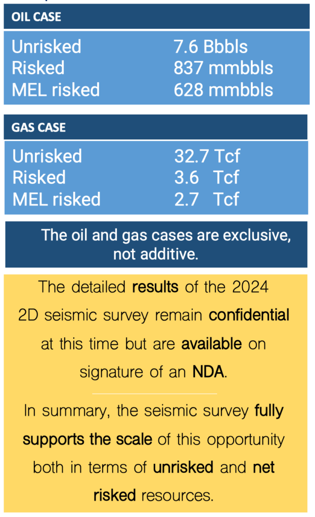
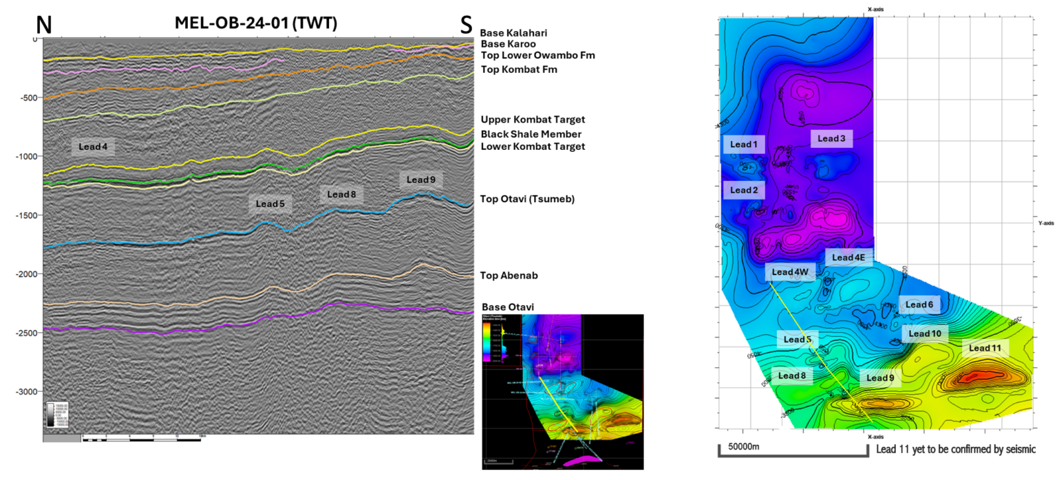
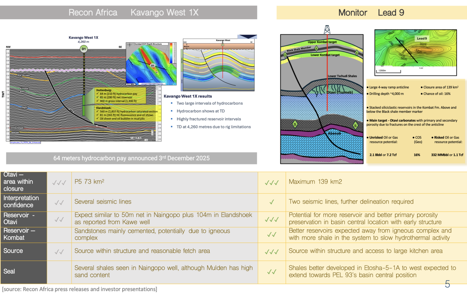
Following interpretation of the 200 km 2D seismic and integration, a new set of volumetric calculations reaffirm the high potential of the acreage, highlighting 11 distinct leads with significant hydrocarbon prospectivity and confidence in the scale and quality of the subsurface structures. Detailed volumetric data is disclosed to potential investors in advance towards drilling operations.
Results of 2D seismic confirm prospectivity of up to 11 leads. One structure has an area in excess of 100km2 with significant vertical relief andclear access to hydrocarbon chargefrom source rocks.
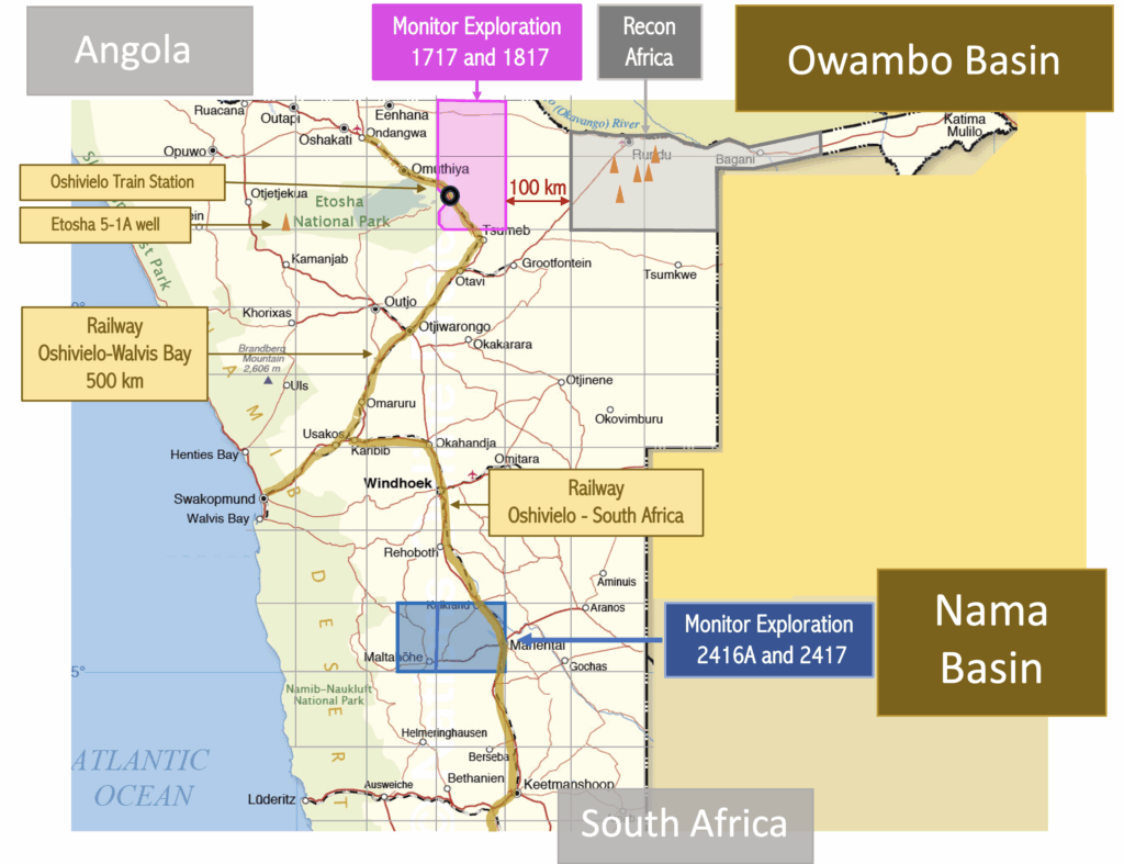
New Petroleum Agreement signed in the Nama Basin, onshore Central Namibia.
203 line km of 2D seismic completed deploying vibroseis to improve data quality. Acquisition in June-July 2024: on time, on budget, no incidents.
First results expected in October 2024.
Tender invitation to selected companies to provide 2D seismic bids for 200 km. Contract signature: May 2024. Acquisition: July-August 2024. First results: Sept-October 2024.
New licence negotiated in Nama basin, onshore Central Namibia. Procedure for signature.
20% Working Interest transferred to 88 Energy. Invitation to Tender out to selected bidders for min.200 line-km of 2D seismic acquisition. New Work Program & Budget for the First Renewal Period agreed with license partners. New exploration licences under negotiation in and outside Namibia.
The new 2D seismic confirmed the westerly dip on the AOI 02 structure, and connects with the existing seismic grid in AOI 00, where a distinct high is observed and additional structures are mapped.
Acquired two lines for a total of 60 km of new 2D seismic and tested the Accelerated Weight Drop (AWD) source in our geological setting.
Following the acquisition of 2D seismic over their acreage, ReconAfrica have now recognised the very significant potential of the Damara fold play which has always been Monitor’s primary focus.
ECC (Environmental Clearance Certificate) signed, valid for 3y, granting authorisation to commence 2D seismic. Change of velocity in depth calculation by means of using passive seismic dataset from 2018.
Completion of EIA and EMP. Ready to start with 2D seismic preparations for operations. Initial Exploration Period of our PA was extended with 12 months, until 02 Oct 2023.
Commencement of Environmental Impact Assessment (EIA)and Environmental Management Plan (EMP), authorization expected end Q2 2022, and schedule to proceed with 2D seismic operations immediately after.
Derisked our prospects further by purchasing additional G & G, namely the well data of Etosha 5-1 and ST-1 as well as 750 km of 2D seismic lines to tie to our AOIs.
Working Petroleum System ReconAfrica announce drilling results proving a working petroleum system in the Owambo basin, significantly de-risking MEL’s acreage.
Data Integration Report completed by Pioneer and resource estimate numbers are calculated.
Results from passive seismic spectroscopy and remote sensing are available, and in process of combination with existing data, such as conventional seismic and gas shows for the area.
Remote Sensing and Passive Seismic surveys carried out.
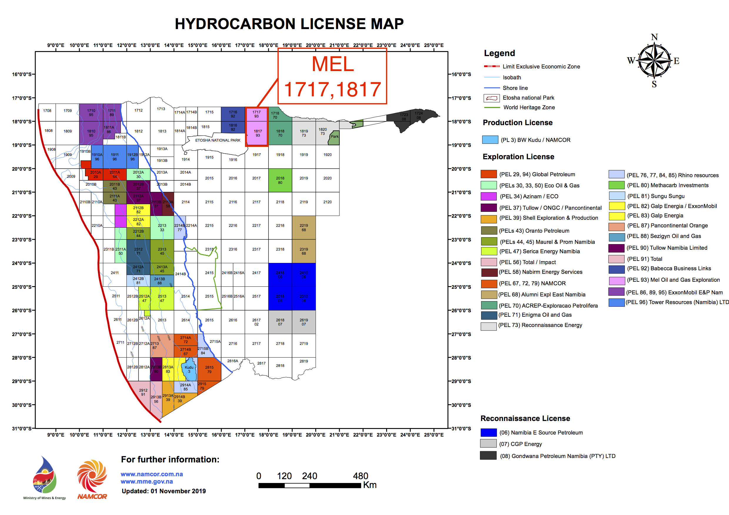
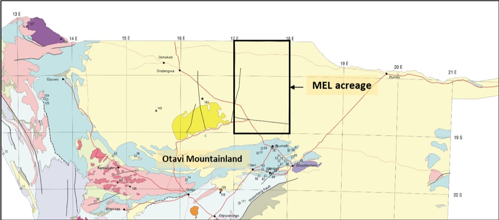
Monitor signs the Petroleum Agreement for blocks 1717 and 1817. PEL 93 is assigned.
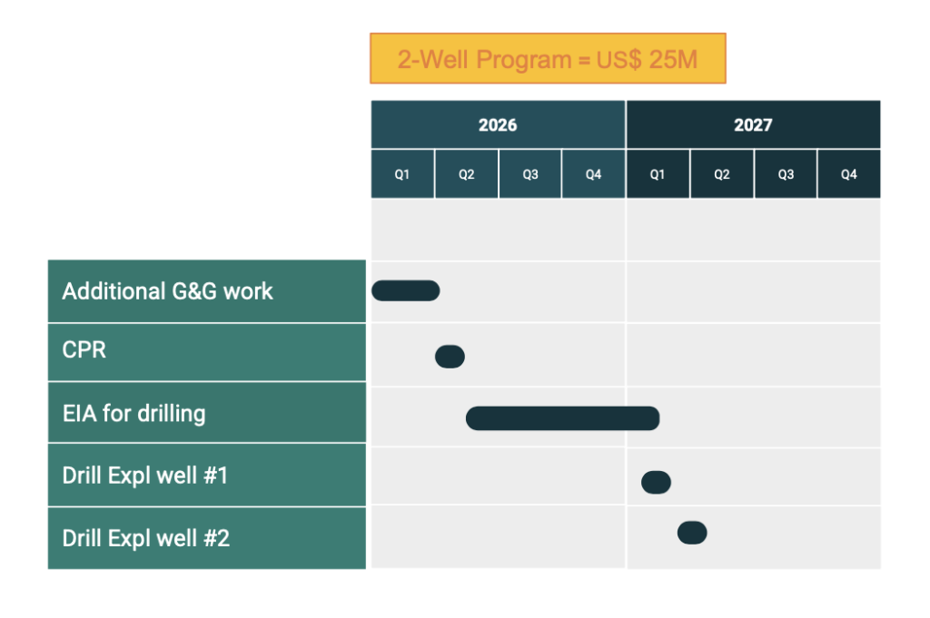
Until October 2026
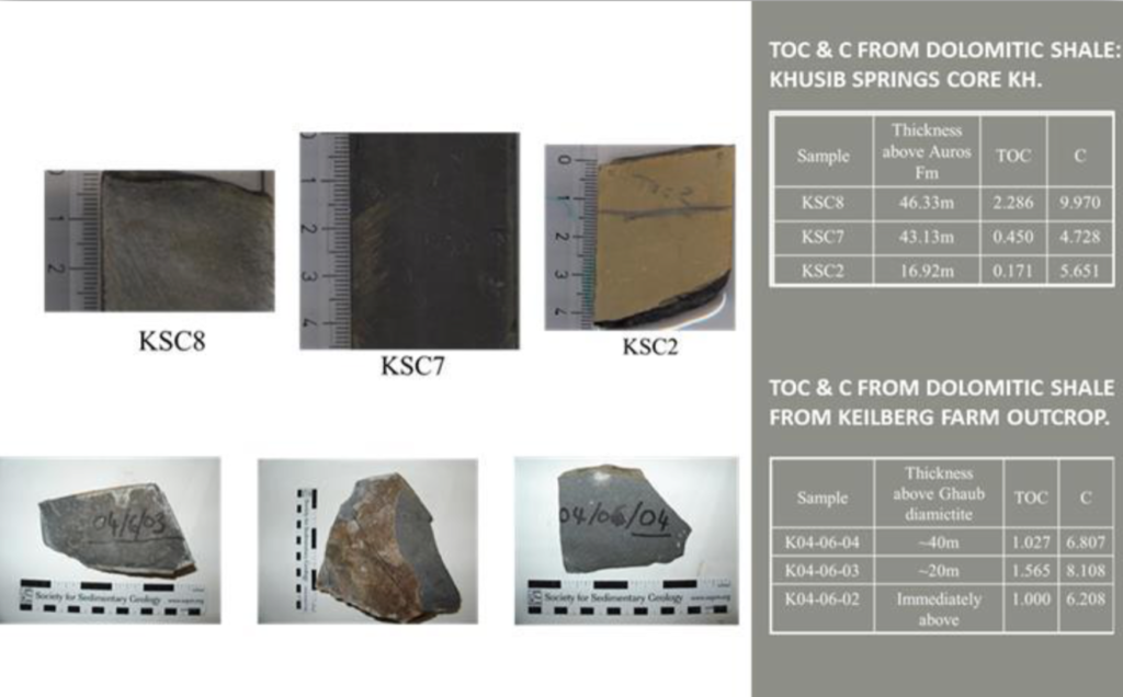
Source Rock
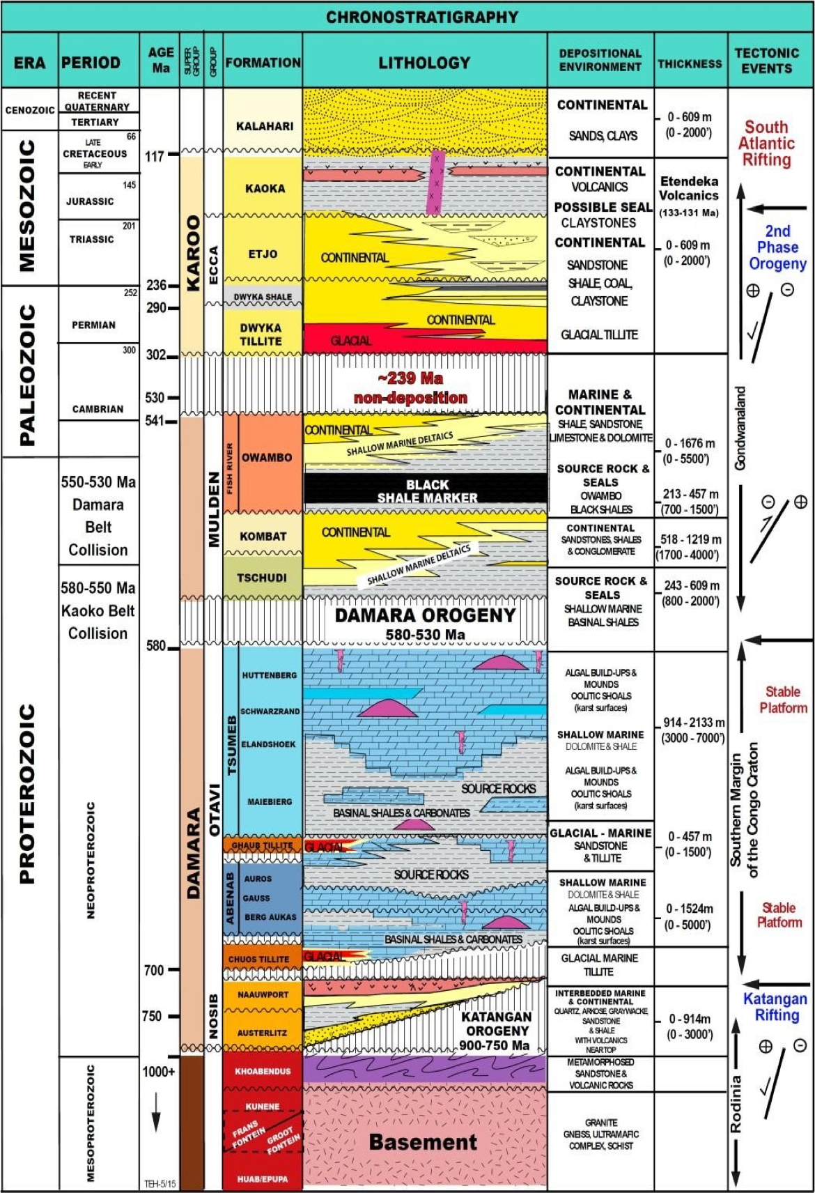
There is increasing evidence that deposition of many mid to late Neoproterozoic (to Early Palaeozoic) organic-rich units was triggered by strong post-glacial sea rise on a global scale, following the “Snowball Earth” type glaciations.
The source rocks with favourable generation potential associated to Otavi Group carbonates in Owambo basin should be distributed immediately to the north of Damara fold belt and to the east of Kaoko belt where the foredeep depozone of the foreland basin system developed.
Reservoirs
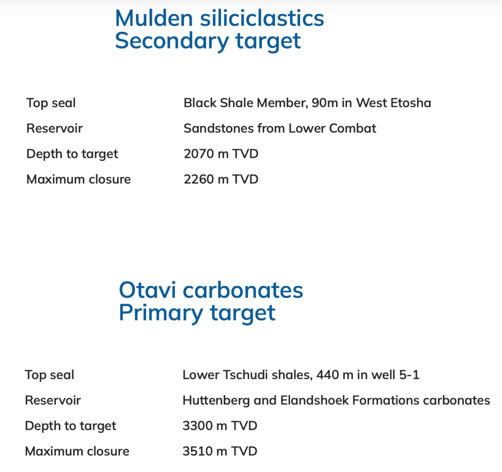
Potential reservoir rocks in the Owambo basin include Proterozoic carbonates of Otavi and sandstones of the Mulden group. Intra-Damara paleokarst structures may have lost of their porosity but various post-Damara episodes of karsting have produced cavernous porosity which is a major source of groundwater in the basin margins.
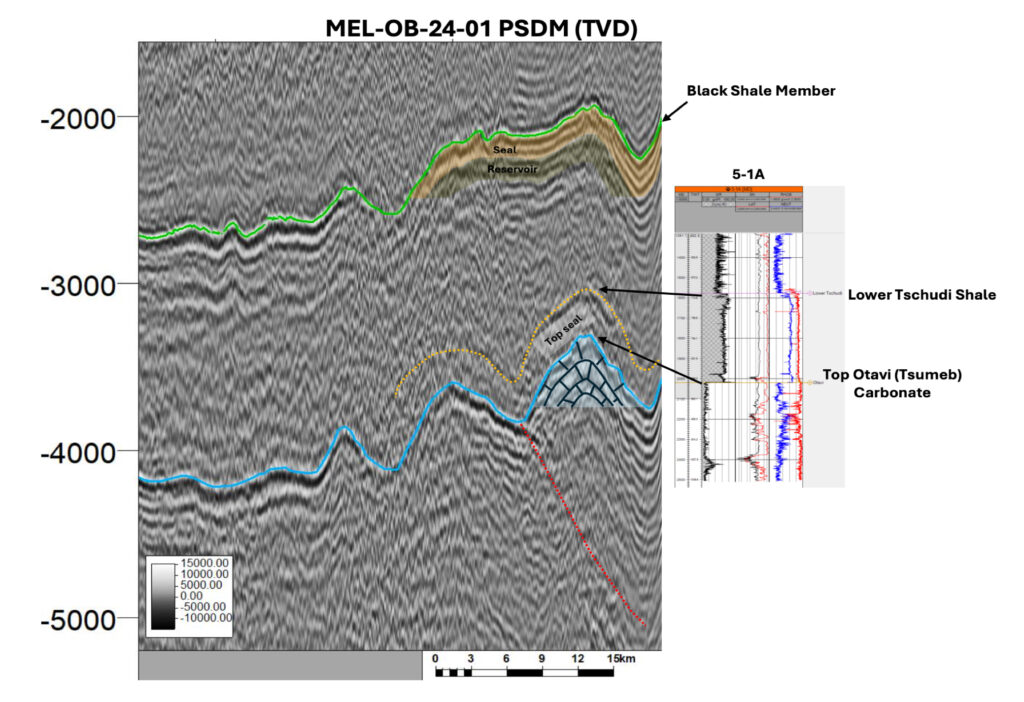
Porosity of Otavi carbonates ranges from 15% in logs and 21-37% in outcrops.High permeability in the upper most Otavi Group stratigraphic interval has been encountered in Etosha 5-1A wellbore.

Traps and Exploration Targets
Analysis and interpretation of available 2D seismic data over the blocks, have allowed the identification of four main types of plays within the blocks 1717 and 1817.
A. Ramp anticline: These are large anticlinal folds against thrust faults which have been recognized on gravity and magnetic data as elongated anomalies with SW-NE to the south of the thrust belt front. The anomalies are supported by the structural model defined for a fold a thrust belt. Similar structures have been confirmed by Etosha 5-1 well and seismic data to the west of the basin which are contained within the same structural trend as explained above.
B. Antiformal structures within the fore-bulge depozone: are located to the north of the thrust belt front and are formed due to the push down of the stacked tectonic sheets.
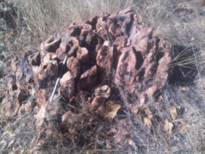
C. Carbonate mounds: mounded features observed on seismic data and outcrops. Stromatolites are the main reservoir units with excellent porosity and permeability.
D. Tectonic inversion anticlines: Anticlinal structures formed as a result of the tectonic inversion of rift-related faults. Nosib siliciclastics, Abenab and eventually Tsumeb carbonates form positive structures identified on seismic.
According to one of British Petroleum’s speeches, held by Mr. Michael C. Daly, BP’s Executive Vice President Exploration, “Future Trends in Global Oil and Gas Exploration”, looking over the next 30 years, there are three potential sources of yet to find oil:
With the prospect of lower demand sooner than assumed at the time of his speech, and weaker prices for oil and gas, the risks and costs of the first two may make them relatively unrewarding in terms of returns for risk and capital involved.
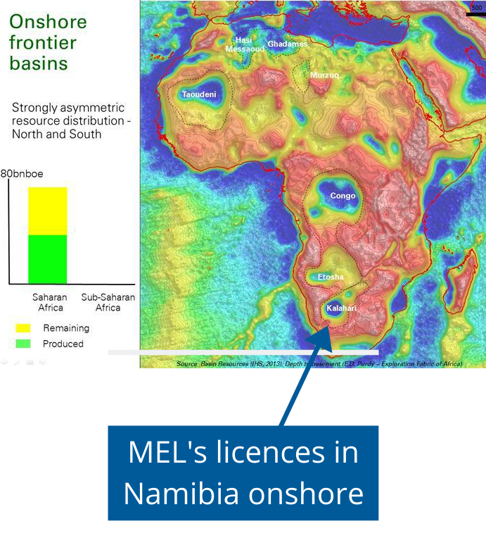
On the third source, he particularly points to sub Sahara of Congo/Angola/Namibia as one of the prominent future prospects to follow. “Onshore, the remaining frontiers and deep land will follow with low cost, low impact, high quality seismic being key.”
Read the speech here.